 |
| Mount Rose has a tiny summit and lots of ticks |
Well, I finally got a chance to hike this week. I could not hike over the weekend due to
being out of town and in a city. I could
not hike Monday, Tuesday or Wednesday due to legal battles. I could hike on Thursday, but I had to cancel
my dental appointment to do it. I had a
filling fall out two years ago and I can never find the time to see the
dentist.
Thursday morning I woke up at 4am with a sinus headache or a
migraine. I took a sip of homemade ginger
ale in the hope that the sugar and alcohol would help with my headache. I woke up again at about 5:30 and was totally
disoriented I could not remember if I had a reason to even get up this morning,
school was over, life was over, there was nothing left. I think I woke up in the middle of a panic attack! I woke up again at 7:20 when my alarm went
off, and then I remembered that school was not over, life was not over and it was hiking day.
I still had a headache plus nausea, great. I decided to try to hike anyway. But first I had to get my daughter off to
school. She did not want to wake
up. It took a lot of effort to get her
moving and when I finally had her dressed and ready it was 8:20. Then she wanted to drive her to school, so I gave
her a ride. I knew I was going to get
off to a late start and I had a limited amount of time to hike. As usual I had to race with a train to drive
my little one to school. About every
other day a train blocks the route to her school and makes the school bus even later,
that is why I drive her to school.
I thought I had avoided all the trains so I headed down the
street below Kneeland Park only to see a HUGE long logging train come right at
me and covering my next intersection on highway 3. So
I whipped a U turn and drove as fast as I could to the train track crossing
on 7th that was not yet blocked. I beat the
train and the train gates. But, I had to
drive up and down the hill, wasting time and gas to do it. I got her dropped off and was finally on my way to the trail at about 8:40.
I stopped at Hoodsport to use the fancy new bathrooms. Every step I took towards the bathroom made my head throb. Uh oh.. How was I going to do Mount Rose with my head throbbing? I went into IGA and bought a cup of coffee and a Dove bar to help with my headache. The clerk who rung up my order said she had a headache too and she thought it was a sinus headache from all the pollen in the air.
I got caught behind a slow moving car on 119
but I thought, it’s such a short distance that going 5MPH slower will not really
make me lose too much time. If I was going
100 miles then going 5mph slower would cost me some time. I stayed behind the slow moving car until 3 other
cars got stuck behind me and then I passed it.
I forgot what a relief it is to not have to look at a car. It’s almost worth passing someone just to not
have to look at them.
I made it to the trailhead at about 9:40 and I was able to
start hiking right away as I had eaten breakfast at home. Normally I eat breakfast at the trail
head. Breakfast is oatmeal with milk
sugar and raisins. I cook it at home and
then eat it at the trail head since my stomach rebels against food first thing
in the morning.
I decided to hike up
the long way and down the short way.
Someone had lost a GPS on the long route and I was hoping to find it and
return it to them. I was mindful of the
time but I knew I did not really have to race.
It was quite warm and I was not feeling very good, so I was glad I did
not have to race.
I reached what I call “one hour rock” after 1 hour and 8 minutes,
so I was a little slower than usual but not by
too much. I took pictures of a
snail and slug before I reached the rock.
I did not stop to take pictures of millipedes even though I saw two of
them. I’ve gone off millipedes as they
remind me of someone.
It seemed to take a long time to reach hose camp and I was
really sweating by the time I got there.
I turned right up the long route and searched for the lost GPS at both
creek crossings with bridges. No luck,
the GPS was gone. Most of the snow on
the long route has melted. The first
snow started just below the ridge. I got
out my trekking poles once I hit the snow.
I also glanced at my watch and saw I was making really poor time. I was only going to be able to have a ½ hour
lunch break instead of my usual hour and I still might risk not getting home in
time. I had to be back to my car by 3pm
and I figured it would take me 2 hours to go down the short route at a comfortable
rate, as it takes me 2.5 hours to go down the long route. That made 1pm my mandatory turnaround
time. I like having knees that work, so I won’t race
down a hill like Mount Rose.
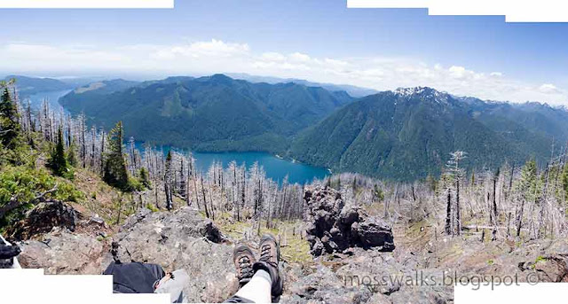
I finally reached the summit rock at 12:30. There were purple penstemon flowers blooming
on the summit. There were no clouds in the sky but still the view was a bit
hazy. I could see all the volcanoes from
the summit. I can’t remember the last
time that happened. I was very warm on the summit rock so I did not boil water
for coffee. I took my vinacafe and shook
it up in my water bottle and made a nice cold coffee. I poured water onto the summit rock for
Patches to drink and I fed her a whole bag of dog treats.
For lunch I had three roma tomatoes, sunflower seeds and a
little bag of M and M’s. ½ hour was a
short lunch break for me, but not having
to boil water saved me some time and I did not feel as rushed as I thought I
would.
At 1pm I headed back down the hill, pausing to take
pictures. It’s been a very long time
since I’ve gone down the short route, so it all felt new to me. I can do Mount Rose over and over again in
the spring and it feels different every time thanks to the plants that come up
at different times and the changing snow levels. I made better time than expected coming down
and was back to my car by 2:30. So it
only took me 1.5 hours to go down the short route at a pace that does not kill
my knees.
I felt pretty good as long as I was hiking. After I got home the headache and nausea hit
twice as hard and I had to go to bed.
Now it’s the next day and I still feel sick. I paid the price for getting out, it is worth
it!
7 miles 3,500 feet elevation gain
 |
| Snail without a shell |
 |
| Snail with a shell |
 |
| Mean Goat on the Mountain |
 |
| One hour rock |
 |
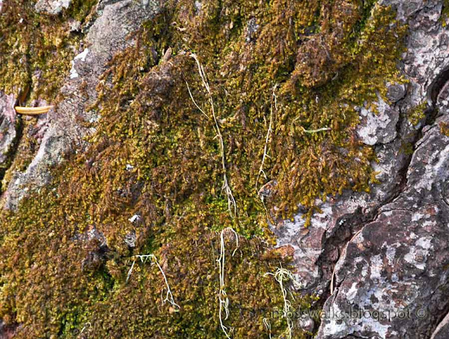
| Green stuff |
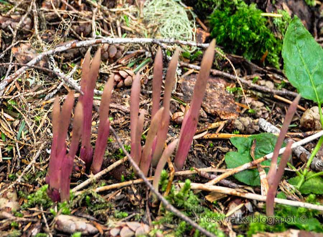 |
| Orchids or mychoheterotrophs |
 |
| Ptilidium californicum liverwort on the ridge |
 |
| The mountain through the haze |
 |
| Penstemon on the summit rock |
 |
| Pack on the summit before it fell apart |
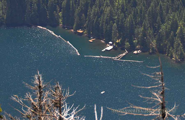 |
| Houses on the other side of the lake. Are they boat in only? |
 |
If I was this tree I could spend my entire life on the summit of
Moun Rose |
 |
| Forest near summit |
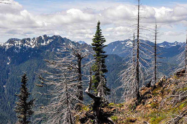 |
| Forest near the summit lightening peak in back left |
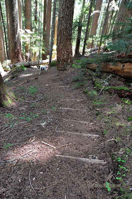 |
| Who needs a stairstep machine |
 |
| Forest on the short route |
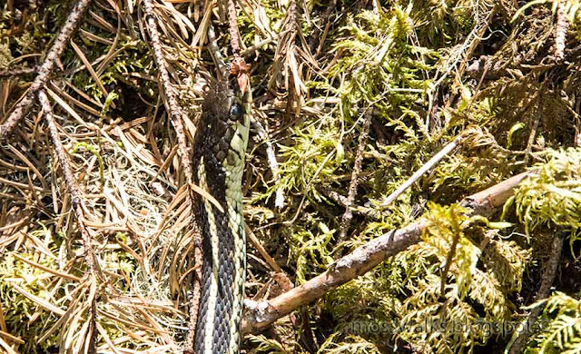 |
snake in the moss. I walked around this snake. Fat
female garter snakes will bite. |
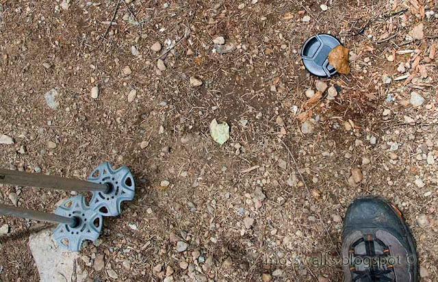 |
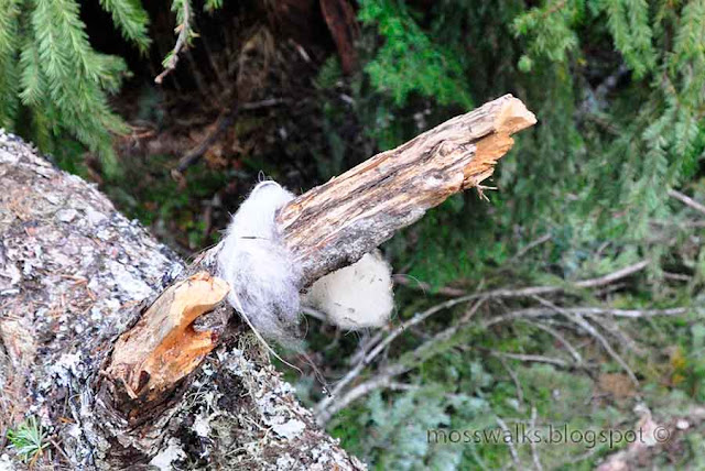
| I did not know I lost my lens cap until I found it on the way back down |


